-
Greater Wellington Regional Council Annual Report Summary 2011/12
Summarises Greater Wellington's Annual Report for 2011-2012,
covering the key achievements in resource management,
transport, water supply, parks and forests, land management,
flood protection, regional sustainable development and the
community.…alarm Published 01 Oct 2012 -
Greater Wellington Regional Council Annual Report 2011/12
Greater Wellington's Annual Report for the year 2011-2012.
alarm Published 01 Oct 2012 -
Quality of Living: Wellington City Survey - Mercer, 2012
The information and data obtained through the Quality of Living Reports (the “Reports”) are for information purposes only and are intended for use by multi-national organizations and government agencies that…
alarm Published 30 Sept 2012 -
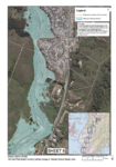
Appendix E: Flood Hazard Maps
This document contains the potential erosion hazard areas included in the consent application.
alarm Published 13 Sept 2012 -
2011/2012 Annual Monitoring Report on the Regional Land Transport Strategy
This document reports on the statistical data collected of
public transport patronage and vehicular use of the roads
in, out and around the Wellington region.alarm Published 01 Sept 2012 -
Hutt Estuary: Fine Scale Monitoring 2011/12
This report presents the findings of fine scale monitoring
at two sites in the Hutt River Estuary. This monitoring was
undertaken in January 2012 and included assessments of
sediment texture,…alarm Published 01 Sept 2012 -
A New Era of Management for the Parangarahu Lakes Area Information Sheet
A pamphlet which outlines the new management regime for the
Parangarahu Lakes area. It refers to the set up of Te Roopu Tiaki
(which includes both Port Nicholson Block Settlement…alarm Published 01 Sept 2012 -
Western Corridor Plan: Adopted 2012
The Western Corridor Plan 2012 was adopted by the
Regional Transport Committee on 15 August 2012. The
Plan covers land transport services from Otaki in the
north, down through to…alarm Published 01 Sept 2012 -
Water Supply Annual Report for the Year Ended 30 June 2012
This report covers the Greater Wellington Regional Council's
bulk water supply activity for the year ended 30 June 2012.alarm Published 01 Sept 2012 -
Waikanae Estuary: Fine Scale Monitoring 2011/12
This report presents the findings of fine scale monitoring
at one site in the Waikanae River Estuary. This monitoring
was undertaken in January 2012 and included assessments
of sediment texture,…alarm Published 01 Sept 2012

