-
Hutt River Mouth - Sediment Input and Aggradation in the Lower Hutt River
The development of a sediment budget for the Hutt River is
critical to making an assessment of the environmental
effects of sediment mining from the river mouth. This
report forms part…alarm Published 01 Oct 2010 -
Hutt River Sediment Transport - Source to Beach
This report discusses the physical environmental processes
operating in the Hutt River, and at the Petone Coast. It
provides the basis for all the Opus technical reports on this
series,…alarm Published 01 Oct 2010 -
Wellington Regional Land Transport Strategy 2010 - 2040 (approved September 2010)
The vision of the Wellington Regional Land Transport Strategy
(RLTS) 2010 - 2040 is to deliver an integrated land transport
network that supports the region's people and prosperity in a…alarm Published 01 Oct 2010 -
Hutt River Mouth - Coastal Sediment Transport Processes and Beach Dynamics
This publication reports on a range of measurements carried out
on the lower channel of the Hutt River, between Waione Bridge
and the Hutt River mouth, and along Petone Beach.…alarm Published 01 Sept 2010 -
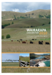
Wairarapa Landscape Character Description Study 2010
This Wairarapa Landscape Character Description documents stage two of the three-part Wairarapa Landscape Study, a comprehensive landscape assessment of the Masterton, Carterton and South Wairarapa districts.
alarm Published 31 Aug 2010 -
Waiwhetu Stream Remediation Project: Final Report
This report summarises the remediation work carried out on
the lower reaches of the Waiwhetu Stream, between Bell
Road and Port Road Bridge (the "U-channel"), including the
salt marsh located…alarm Published 12 Aug 2010 -
Final Report - Waiwhetu Stream Remediation Project
A project to remove contaminated sediments from and widen
and deepen the Waiwhetu Stream was carried out over the
period November 2009 through May 2010. This report
summarises the remediation…alarm Published 12 Aug 2010 -
Wairarapa Landscape Study 2010 - Landscape Character Description Report August 2010
This Wairarapa Landscape Character Description documents stage
two of the three part Wairarapa Landscape Study, a
comprehensive landscape assessment of the Masterton, Carterton
and South Wairarapa districts.
The flow chart inside…alarm Published 02 Aug 2010 -
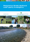
Mangatarere Stream Catchment Water Quality Investigation by J Milne et al
alarm Published 01 Jul 2010 -
Aquatic biodiversity values of headwater streams in the Wellington region
This report presents the results of an assessment of the aquatic
macroinvertebrate values associated with six headwater streams (from
Porirua to near Masterton) in the Wellington region.
Keywords: macroinvertebrates,…alarm Published 01 Jul 2010

